
Case Study: City of Bowie, Maryland
Customer:
The City of Bowie - a mid-sized suburban city in Prince George's County within the Washington, DC metropolitan region - aimed to use place-based economic development to strengthen three core commercial areas: Bowie Town Center, Old Town Bowie, and the Route 450/Main Street corridor. The City believed that making these areas more walkable could increase their economic potential, but needed evidence to determine what to change, where to focus, and why those investments were likely to produce the greatest return.
State of Place worked with the City's Department of Planning and Sustainability and Economic Development Office to develop prioritized, evidence-based urban design recommendations designed to optimize walkability and economic performance across the three focus areas, quantify the upside those changes could generate, and make a stronger case for implementation. The project was conducted in partnership with the Maryland-National Capital Park and Planning Commission (MNCPPC), which provided the office, retail, and residential rent and median household income data needed to conduct the statistical analysis informing the recommendations.
Goals:
1. Identify and prioritize the built environment changes most likely to improve walkability and, in turn, economic value.
2. Provide evidence-based justification for the recommendations to help the City secure approvals, funding, and stakeholder buy-in.
Our Approach :
Today, the majority of citymakers understand that the built environment drives exponential economic, social, health, and environmental value. However, they struggle both to determine which changes to prioritize in light of limited resources and justify the “why” behind proposed investments. To address these challenges, State of Place begins by objectively measuring the quality of the built environment and then developing customized forecasting models that quantify how different aspects of urban design impact the outcomes citymakers actually want to achieve. We then translate that data and evidence into prioritized recommendations regarding what to change, where, and why to help citymakers create more thriving places.
Accordingly, to help Bowie optimize its place-based economic development strategy, State of Place first needed to quantify its existing built environment performance and then understand how that was influencing its current real estate value, relative to the broader Washington, DC metropolitan region. To do so, we collected data not just for the City's three focus areas - which alone did not provide enough variation to build statistically robust models – but also for a sample of places that represented a continuum of urban design quality and economic performance across the region.
First, to assess built environment quality, State of Place used its proprietary AI models to extract data on 127 built environment features from street-level images for every block across Bowie’s three economic development zones as well as the other places included in the regional analysis. We combined those results with real estate, demographic, and economic data and developed separate forecasting models for office, retail, and residential rents and residential property values.
The models showed which urban design dimensions mattered most to each real estate outcome. We translated those findings into evidence-based recommendations designed to optimize economic value based on Bowie's existing conditions and capacity. We then applied spatial logic so the individual changes worked together across surrounding blocks, connected corridors, and each economic development zone as a whole.
This approach built on the methodology our Founder and CEO, Dr. Mariela Alfonzo, developed and applied for a 2012 Brookings Institution study and subsequent MWCOG research, which quantified the relationship between urban design and real estate value across the Washington, DC region. For Bowie, State of Place expanded the original 66-neighborhood sample to 78 places and rebuilt the models using updated, post-pandemic data.
Methodology :
State of Place collected and analyzed current built environment and real estate data, developed updated forecasting models, translated the results into prioritized block-level recommendations, applied spatial logic, simulated all possible combinations of those recommendations, and quantified the economic upside and return on investment associated with the highest-performing scenarios. The following sections describe the data, analysis, and scenario development used to generate Bowie's evidence-based recommendations.
1. Data Collection
1a. Sample
Bowie Town Center, Old Town Bowie, and the Route 450/Main Street corridor
78 places across the Washington, DC metropolitan region representing a range of urban design and economic conditions
1b. Data Types
Data on 127 street-level urban design features (e.g., sidewalks, benches, street trees, parks, curb cuts, land uses, etc.) generated from images using visual machine learning
Real estate, demographic & economic data (Figures 1.1 & 1.2)
2. Analyze the Relationship Between Urban Design Features and economic outcomes:
Develop separate regression models for office, retail, and residential rents and residential property values, incorporating demographic and economic data to isolate the impact of urban design on real estate performance
3. Generate and Prioritize Block-Level Recommendations
Translate the forecasting models into prioritized urban design recommendations based on which dimensions had the greatest impact on each economic outcome
Prioritize changes based on Bowie's existing conditions, the urban design dimensions that mattered most (per the forecasting models), and the feasibility of changing each dimension within Bowie’s development context
4. Apply Spatial Logic
Refine the block-level recommendations to account for feature dependencies and compatibility, corridor continuity, and a feasible spatial density for certain uses/features within each area (i.e., it is not realistic or necessary to have a park in every block even though in theory doing so would increase its score)
5. Generate and Evaluate Scenarios
Simulate all possible combinations of the spatially contextualized recommendations and filter the results based on implementing 50%, 75%, or 90% of the recommended changes
Select the highest-performing scenario at each implementation level for each of Bowie's three focus areas
Forecast the real estate upside and estimate the return on investment for all nine selected scenarios
6. Communicate the Findings
Present the results to the Bowie City Council to support strategic investment planning, funding, approvals, and stakeholder buy-in
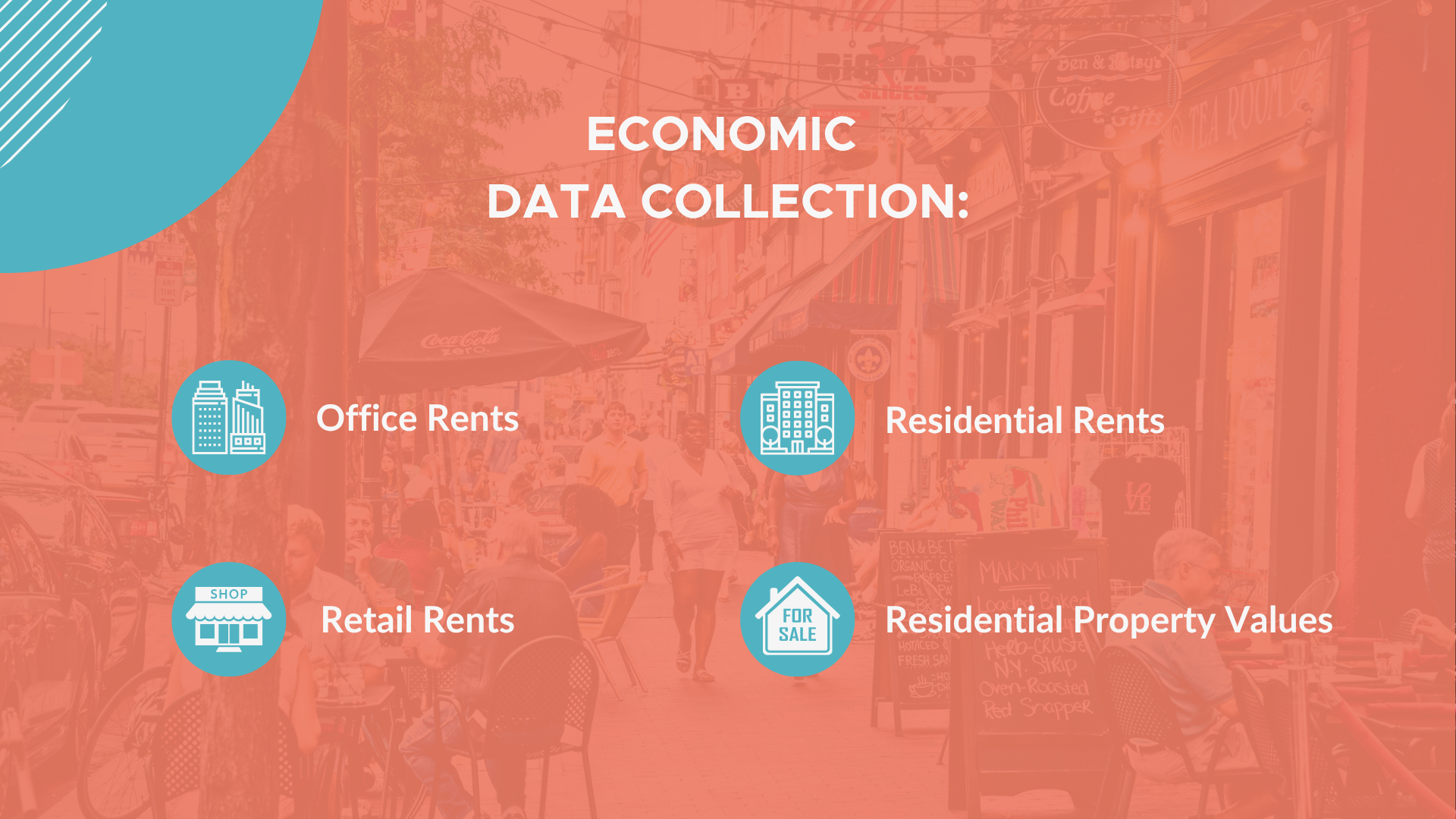
Figure 1.1: Economic Data Collection Categories
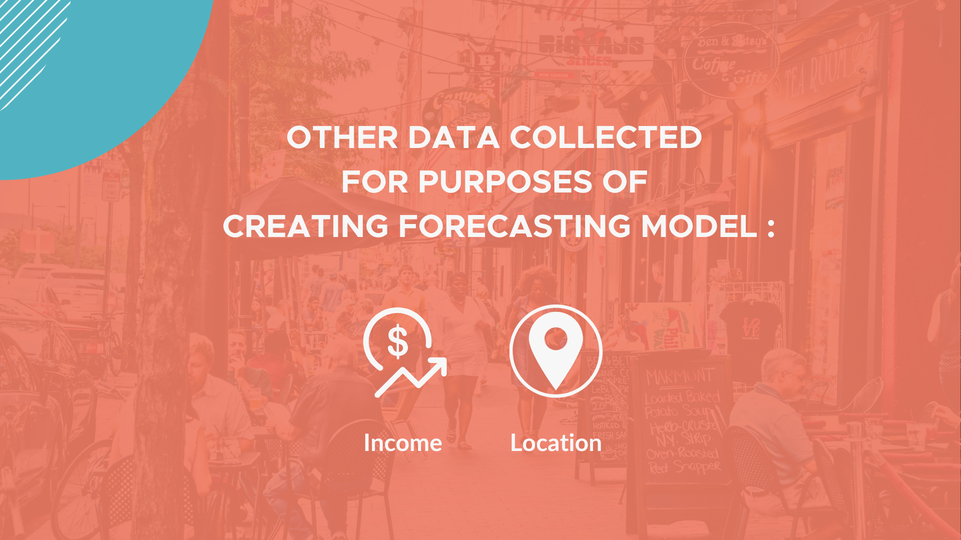
Figure 1.2: Other Data Collected
The Process
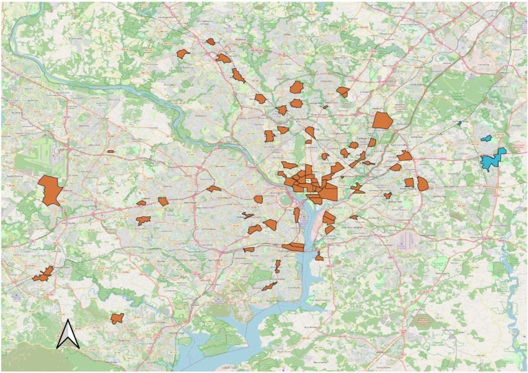
Figure 2: Bowie Updated Geographic Sample, 2022
State of Place retained the 66 neighborhoods included in the original Brookings/MWCOG analysis as the foundation for the updated study, collected entirely new data for each, and expanded the geography to 78 places by adding areas that increased the range of built environment quality and economic performance represented in the regional dataset. We also added Gaithersburg and Annapolis because Bowie had identified them as key competitors and wanted them included in the analysis (Figure 2).
To measure urban design, State of Place assessed approximately 20 street-level images per block and processed them using visual machine learning models trained to detect 127 built environment features. Our proprietary algorithms converted those data into the State of Place Index and Profile for each block. The Index is a validated score from 0 to 100 composed of ten subindices (the Profile) that measure dimensions known to influence walkability and other aspects of value:
Density, Form, and Connectivity, which comprise an area's Urban Fabric
Proximity, Parks and Public Spaces, and Recreational Facilities, which comprise overall Destinations
Pedestrian and Bicycle Amenities and Traffic Safety, which comprise an area's Comfort
Aesthetics and Personal Safety, which measure Pleasurability
Forecasting Economic Value
MNCPPC provided current office, retail, and residential rents for each area included in the analysis, along with median household income data from the Census. State of Place aggregated the block-level Index and Profile scores for each place and combined them with these economic and demographic measures. Including income in the regression models allowed us to isolate the relationship between urban design and real estate performance so differences in value could be attributed to differences in place quality rather than differences in household income.
Measuring Bowie's existing conditions identified its assets and needs, but prioritizing recommendations based only on the lowest scores would assume that every urban design dimension matters equally to every outcome. State of Place's prior research has shown that they do not. The forecasting analysis was designed to determine which aspects of urban design had the greatest influence on each of the four real estate measures within the Washington, DC market.
All four models were statistically significant and showed that the relative importance of the ten dimensions differed for each economic outcome. For example, Traffic Safety had a greater effect on retail rents, while Pedestrian and Bicycle Amenities mattered more for residential rents. Rather than simply recommending improvements where scores were lowest, these results allowed State of Place to prioritize changes based on where they were most likely to help achieve Bowie's economic development goals, while also accounting for existing conditions and the feasibility of actually implementing recommended changes.
Prioritizing Block-Level Recommendations
State of Place prioritized the ten urban design dimensions using three criteria:
The current score for each dimension, with greater priority given to lower-scoring aspects of the built environment that had more room for improvement.
What the forecasting models showed mattered most to Bowie’s targeted economic outcomes.
The feasibility of changing each dimension. For example, Form is harder to alter once building height and massing are in place than Aesthetics, which can often be improved through maintenance and visual upgrades.
This process produced a ranking of the ten dimensions based on their importance to Bowie’s economic development goals. State of Place then identified which of the 127 individual features within the highest-priority dimensions would have the greatest effect on each block’s Index and Profile scores and used those results to generate specific recommendations for every block.
ADding Spacial Context
While State of Place generated recommendations for every block, urban design cannot be planned one block at a time. Optimizing each block independently could produce unrealistic outcomes across an entire economic development zone - for example, recommending a park, library, or restaurant on every block simply because it improved each block's score. Likewise, some improvements, such as sidewalks or bike lanes, only make sense when they continue across multiple blocks. To account for these relationships, State of Place embedded spatial logic into the recommendation engine.
The spatially contextualized recommendations applied the following rules:
Related changes were recommended together. For example, adding a bike lane could also require reducing the number of vehicle lanes.
Dependent features were paired. For example, an arcade could only be recommended where a sidewalk already existed or was also proposed.
When multiple versions of the same feature were possible - such as different types of bike lanes or crosswalk markings - State of Place recommended the option expected to have the greatest impact.
Corridor-based improvements, such as sidewalks and bike lanes, were extended continuously across connected blocks.
Features that can improve the Index but are not feasible on every block, such as parks, restaurants, or civic amenities, were capped based on how frequently they appeared in the top-performing places in the regional sample. Within that limit, State of Place selected the blocks where adding each feature would have the greatest impact.
Figure 3 shows a snapshot of the recommendation output, including prioritized dimensions, specific features, and expected score improvements.
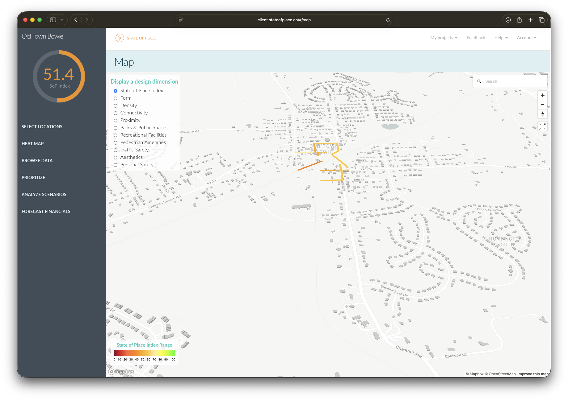
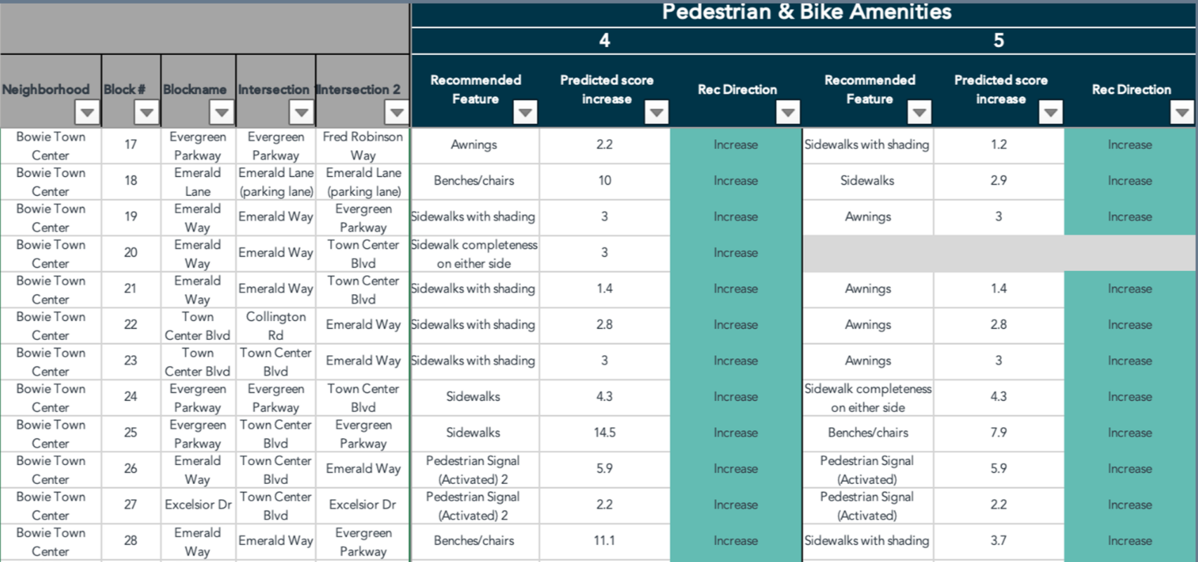
Figure 3: Bowie Recommendation Report Snapshot
From Recommendations to Investment Scenarios
State of Place presented Bowie with prioritized, spatially contextualized recommendations for every block within each economic development zone. The goal was for the City to use its State of Place platform subscription - specifically our scenario tool - to test the impact of those recommendations in real time. The tool allowed them to see how different combinations of proposed urban design changes - such as adding street trees, sidewalks, or benches - would affect the State of Place Index. It gave Bowie the flexibility to explore alternatives, collaborate across departments, and engage residents and other stakeholders in the planning process.
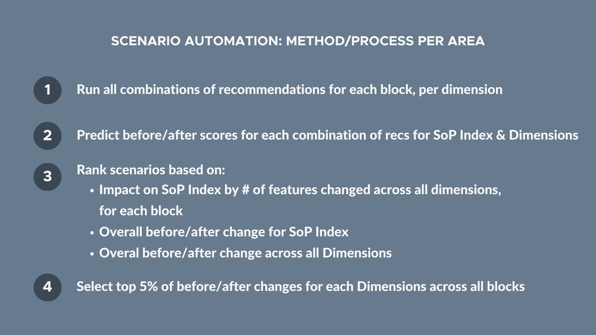
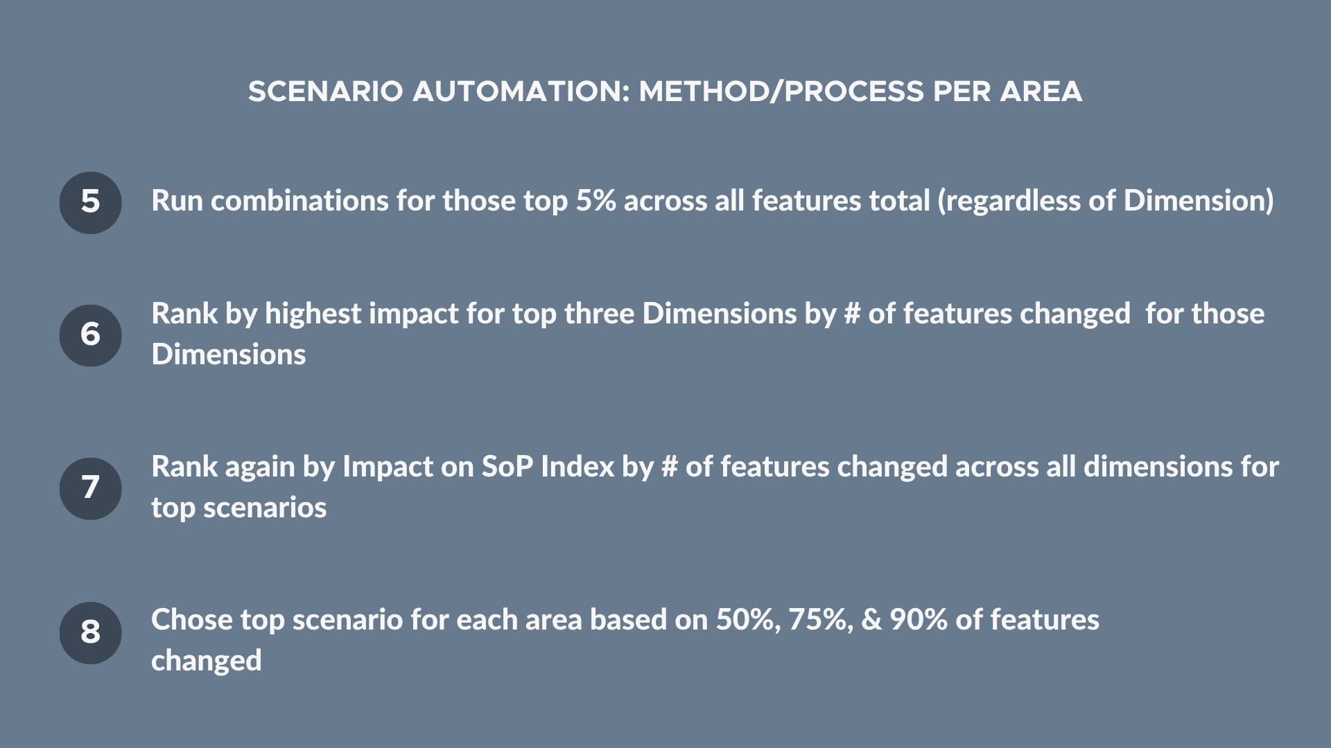
While that approach worked well for testing individual ideas, it could not determine which combination of changes across all blocks would produce the strongest results for each focus area. Once the recommendations were generated, State of Place identified more than 920,000 possible ways to combine them. Rather than leave the City to evaluate those options one by one, we used AI to simulate every possible combination and package the highest-performing results into area-wide scenarios that specified what to change and where across each economic development zone. Specifically, for each focus area, we filtered the scenarios based on implementing 50%, 75%, or 90% of the recommended changes and selected the option at each level that produced the greatest improvement in the State of Place Index. This resulted in nine recommended scenarios - three for each focus area.
By identifying the highest-performing scenario at each implementation level, State of Place transformed hundreds of thousands of possible recommendation combinations into nine prioritized investment options. Bowie could use these scenarios to develop short-, medium-, and long-term implementation strategies, compare low-, medium-, and high-budget approaches, or sequence investments based on staff capacity, municipal resources, and available funding opportunities.
State of Place then used the forecasting models to estimate the additional office, retail, and residential rent premiums, as well as increases in residential property values, associated with each scenario. Combined with estimated implementation costs, these projections allowed us to calculate the return on investment for all nine scenarios. Rather than simply recommending what to change and where, State of Place enabled Bowie to compare alternative investment strategies, identify those with the greatest potential return, and build a stronger case for securing funding, stakeholder support, and City Council approval. Dr. Mariela Alfonzo presented the findings to the Bowie City Council on April 1, 2024.
key Outputs:
1. Baseline State of Place Index and Profile scores for Bowie Town Center, Old Town Bowie, and the Route 450/Main Street corridor
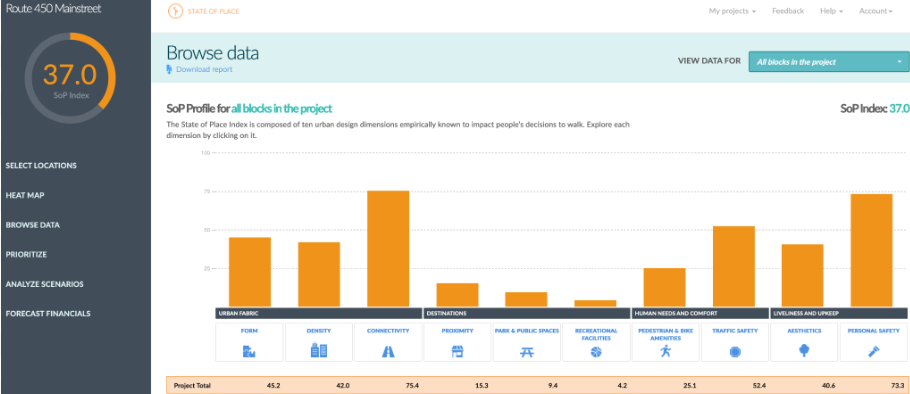
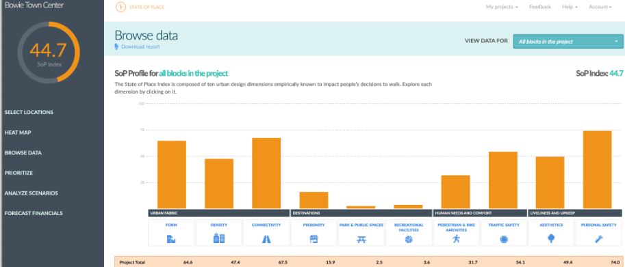
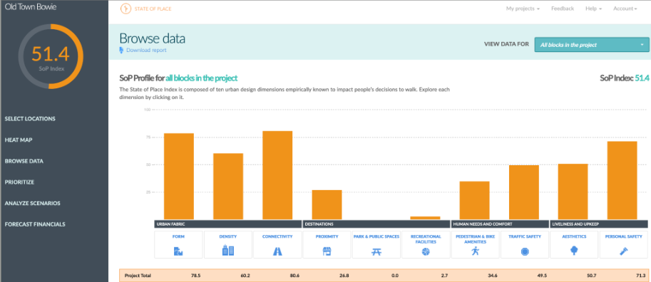
Figure 4: State of Place Index & Profile for Bowie Town Center, Old Town Bowie, and Route 450/Main Street
2. Nine recommended scenarios: one at 50%, 75%, and 90% implementation for each economic development zone
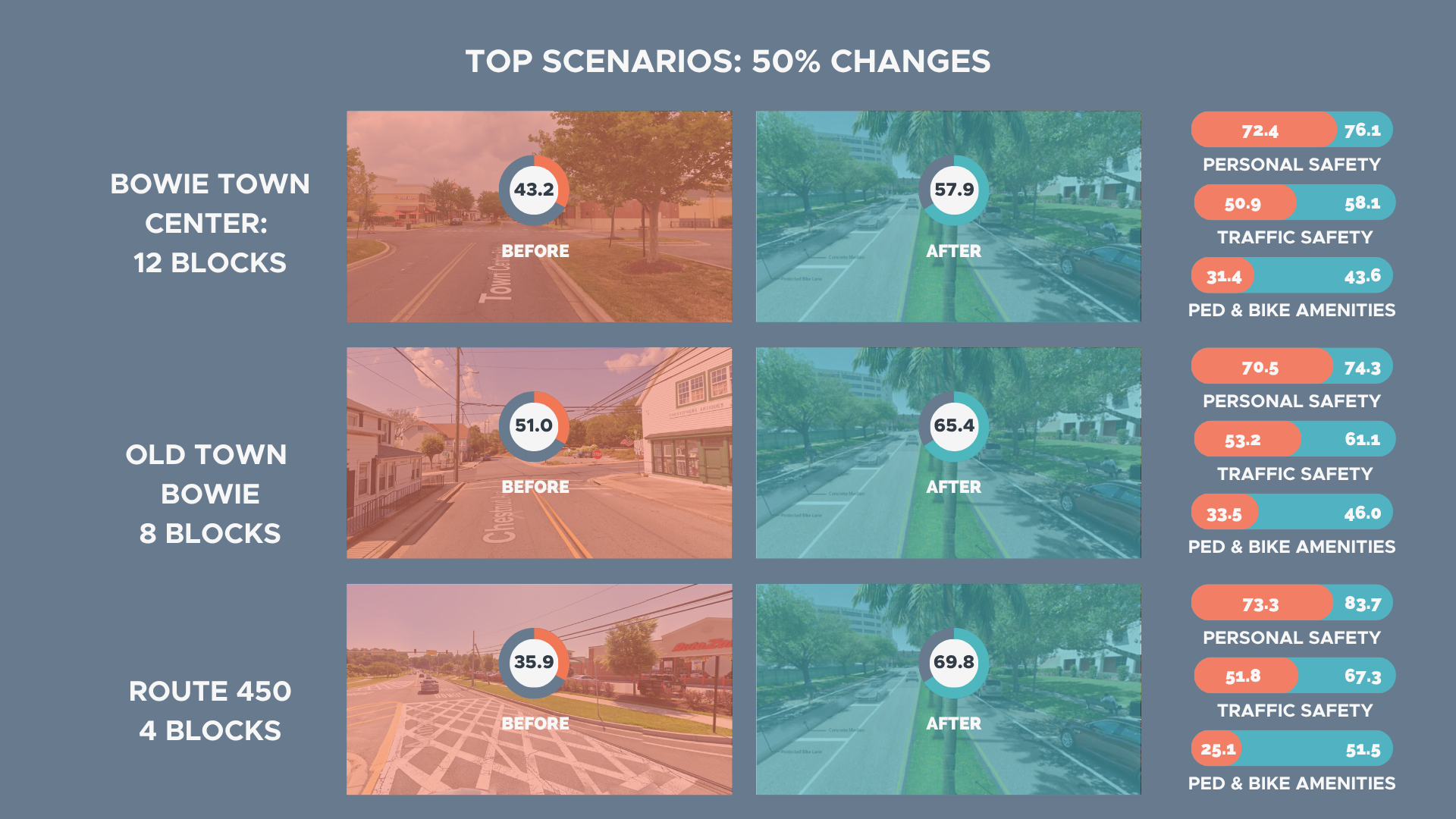
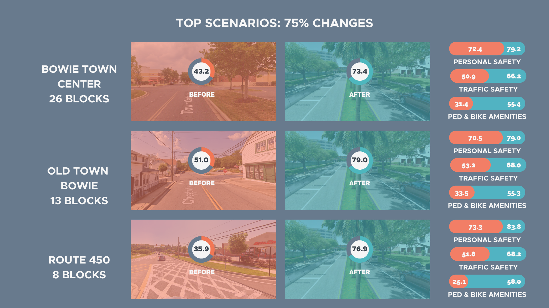
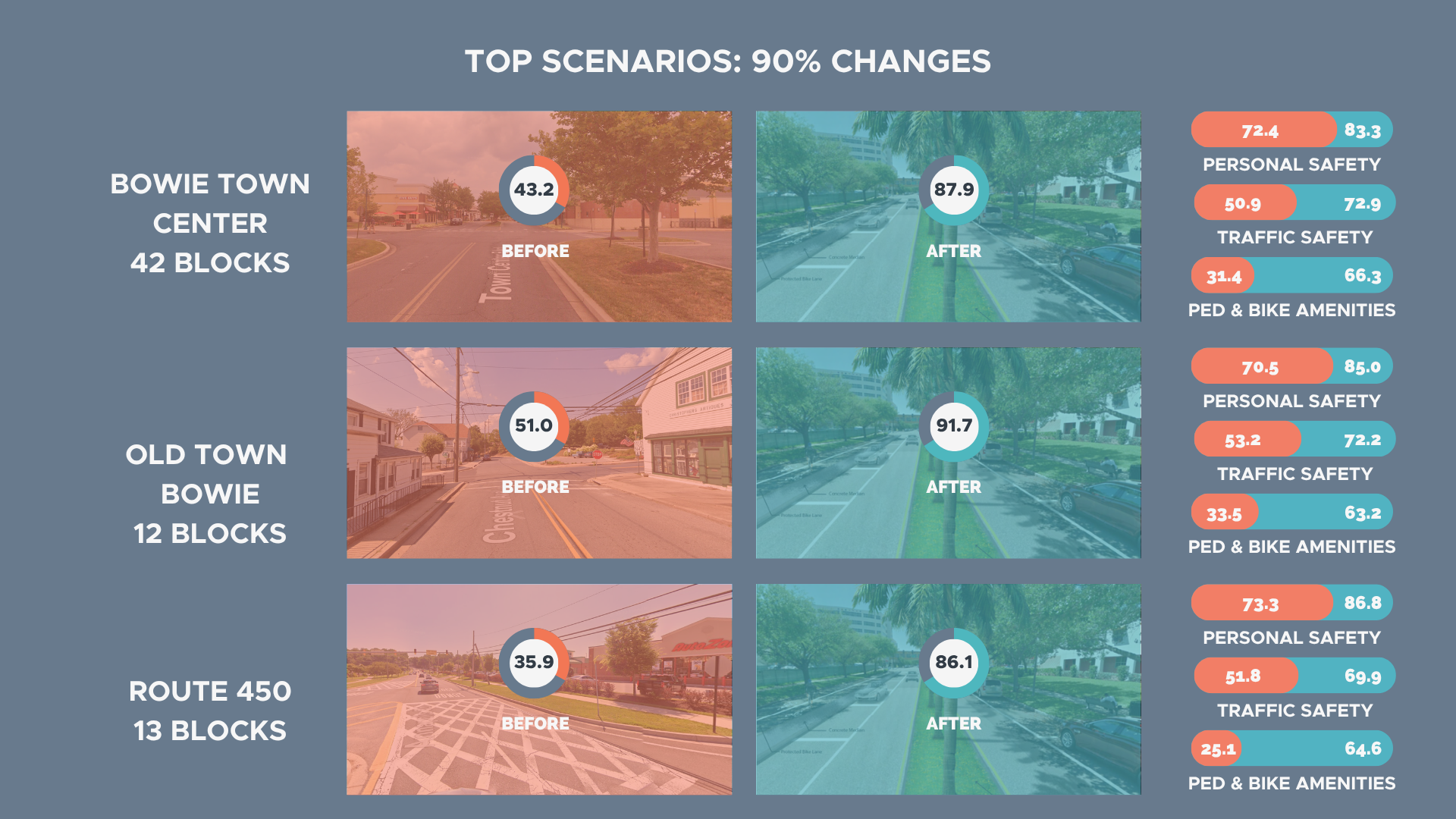
Figure 5: Top Recommended Scenarios at 50%, 75%, and 90% Implementation Levels
3. Forecast economic value and return on investment for each recommended scenario
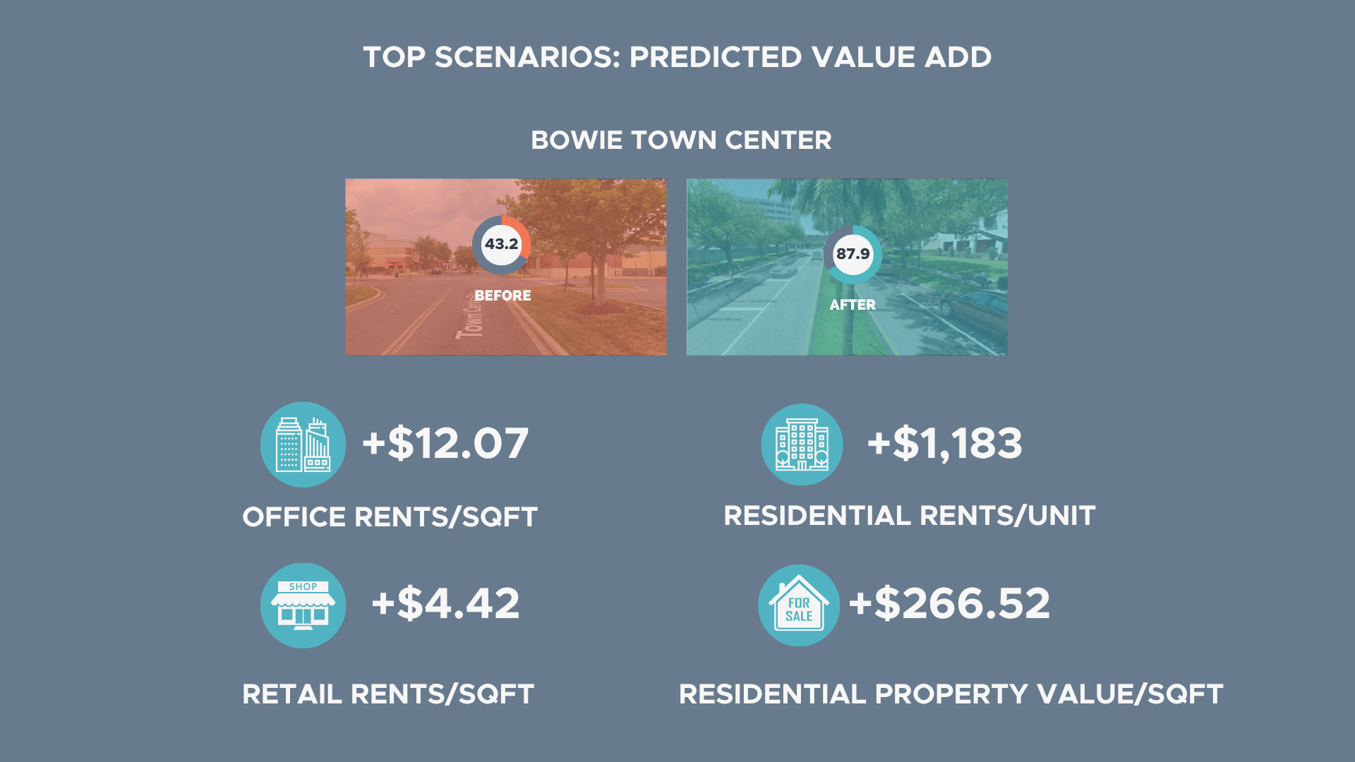
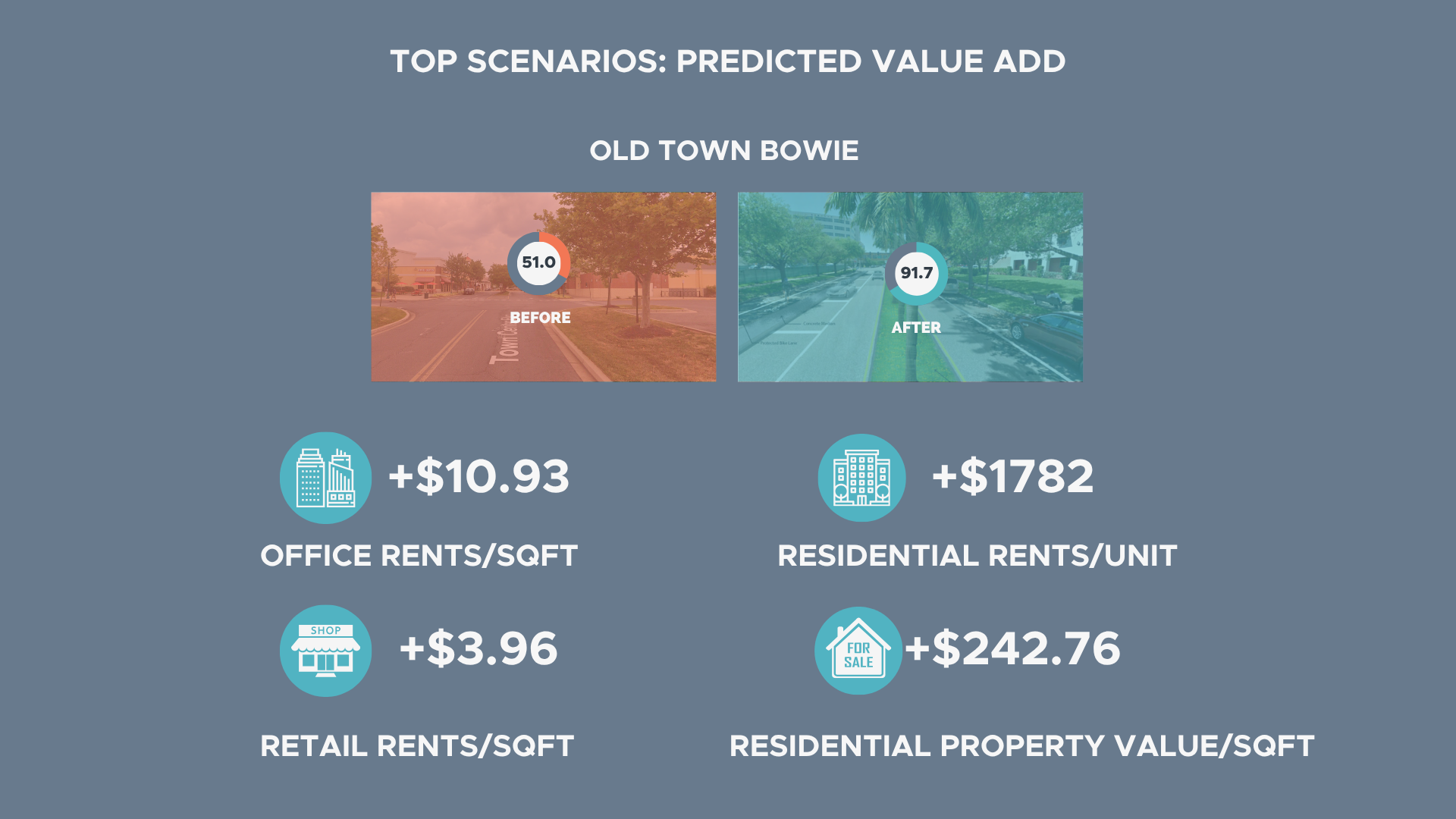
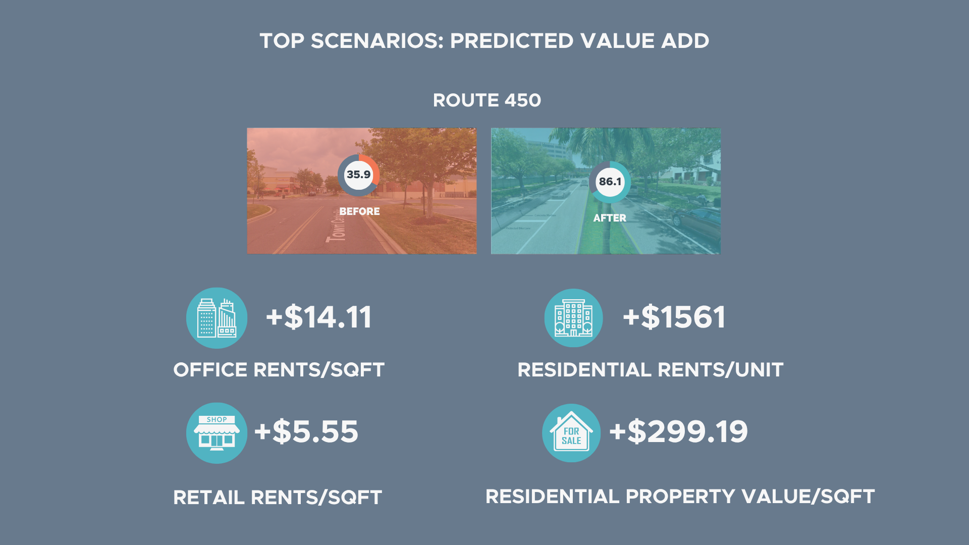
Figure 6: Top Scenarios: Predicted Value Added
value:
Place Quality Benchmark
The State of Place Index and Profile provide an objective baseline of urban design quality across Bowie's three focus areas. The City can use these metrics to assess existing assets, needs, and opportunities, compare performance across neighborhoods in the region, and measure progress over time.
Prioritized, Actionable Recommendations
State of Place guided Bowie on what to change, where, and why - translating the analysis into specific, implementable recommendations for each focus area. Rather than requiring the City to sort through more than 920,000 possible combinations, we identified nine prioritized investment options aligned with different levels of effort, capacity, and goals.
Strategic Investment Planning
The nine scenarios gave Bowie the flexibility to pursue different implementation strategies based on its available resources. Whether the City wanted a lower-cost, phased approach or a more ambitious investment strategy, it could compare the projected impact and economic return of each option, then organize its preferred approach into short-, medium-, and long-term implementation plans.
Economic Impact and ROI
By quantifying the real estate upside and return on investment associated with each scenario, State of Place allowed Bowie to compare built environment intervention alternatives, identify options with the highest potential return, justify its preferred redevelopment approaches, and strengthen the case for funding, approvals, and stakeholder buy-in.